
Difficult Hikes
Boundary Trail


7 mi.
Loop
Difficult
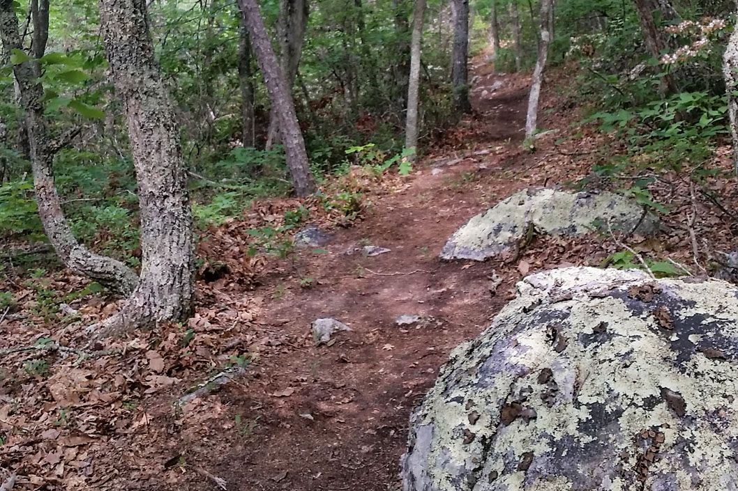
This 7-mile loop follows a long-forgotten county road through rhododendron tunnels to the top of Lick Mountain where it traverses the ridgeline for several miles before it makes its way back to the valley floor and parallels the stream back to the parking area. Take the right leg of the Crystal Springs Loop trail from the parking area for .4 miles, the Boundary Trail will be on your left. Note there are difficult sections of the trail that are steep and rocky, mountain bikers are advised to dismount and walk their bikes.
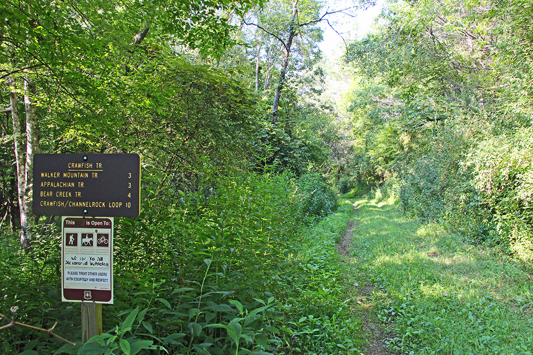
Crystal Springs is an 1,800-acre recreation area offering hiking, mountain biking, camping, backpacking, picnicking, and a Kids in Parks TRACK Trail just three miles from Downtown Wytheville. The thirteen miles of hiking and mountain biking trails range in difficulty from beginner to advanced. The newly built Terrain Park gives the intermediate to experienced mountain biker a fun place to practice on balance beams, teeter totters, rock gardens, log crossings, and other obstacles. There is a lot of history tucked away in the mountains that make up Crystal Springs. Prior to the Town of Wytheville acquiring the property, families farmed and logged the land. Piles of rocks that were cleared from the fields by farmers still stand along Woodpecker Run trail as testament to how difficult farming in the mountains could be. The Short Cut trail and the southern portion of the Boundary trail follow and old wagon road that crossed Lick Mountain. Stories passed through the generations tell of moonshiners using this road to move their product out of the sight of law enforcement. In the 1930’s, the Town of Wytheville purchased the land to preserve the watershed, which flowed to the town, and to build a water reservoir. The reservoir remains and is approximately 60 square feet and 8 feet deep, although years of erosion have fill it with sediment. Hike the Crystal Springs Loop trail to see the remnants of the reservoir. Along the Waterline trail you can see sections of the water pipe that carried water from the reservoir down the valley. Evidence of the past is scattered all throughout Crystal Springs, but you will have to look closely as it is now camouflaged by mother nature.
723 Pump Hollow Road
Wytheville, Virginia 24382
276-223-3368
https://www.wytheville.org/recreation/crystalsprings.php
Crawfish and Channel Rock Loop
5.6 mi.
Loop
Difficult
This trail starts out in beautiful Crawfish Valley, then climbs Brushy Mountain, and descends through the Channel Rock Hollow to the Crawfish Trail and to the parking area. Parking is located off of Strawberry Road.
Mount Rogers National Recreation Area
3714 Highway 16
Marion, Virginia 24354
800-628-7202
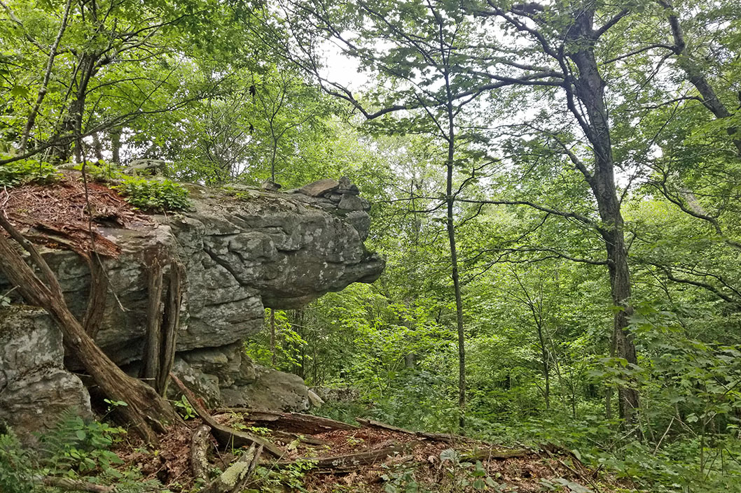
High Rocks Spur Trail
1.7 mi.
Point to Point
Difficult
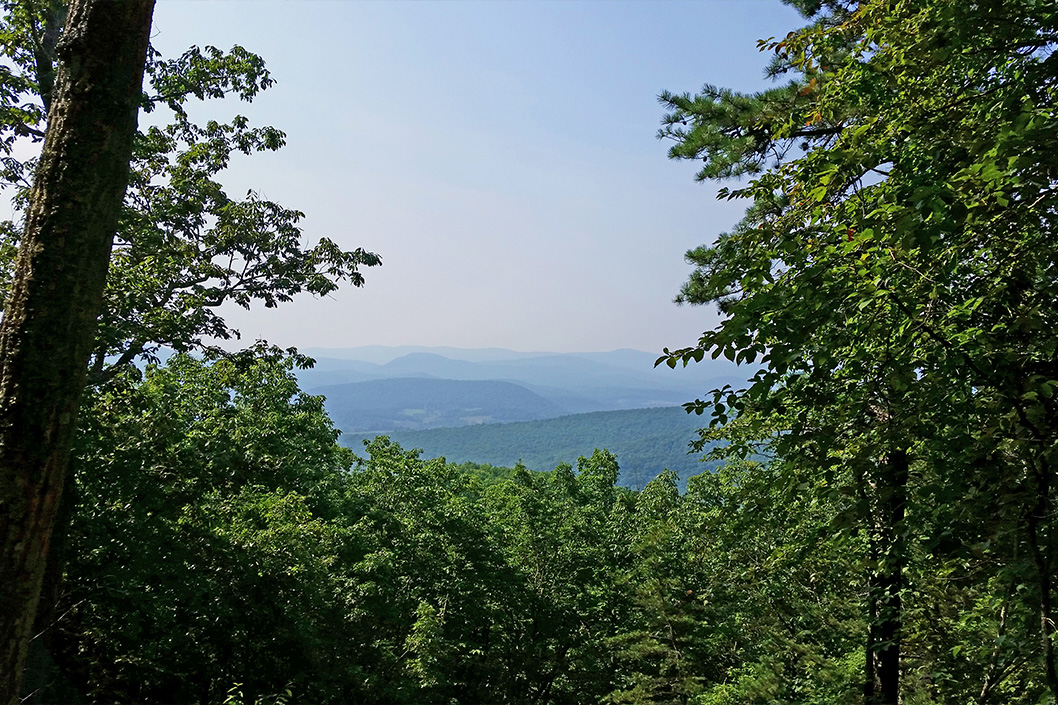
The High Rocks Spur meanders along the eastern ridge-line of Sand Mountain until it reaches the popular outcropping, High Rocks. From High Rocks visitors can enjoy breathtaking panoramic views of the valley, the Town of Wytheville, and the Walker Mountains in the distance. From the parking area it is 2.6 miles to the High Rocks Spurt Trail. The shortest route to the High Rocks Spur trail is the left leg of the Crystal Springs Loop to the Boundary Trail and make your way up the valley to the High Rocks Spur Trail. Note the Department of Game and Inland Fisheries requires you to have an Access Permit or a hunting/fishing license when using their property. See the Department of Game and Inland Fisheries website for more information.
Crystal Springs is an 1,800-acre recreation area offering hiking, mountain biking, camping, backpacking, picnicking, and a Kids in Parks TRACK Trail just three miles from Downtown Wytheville. The thirteen miles of hiking and mountain biking trails range in difficulty from beginner to advanced. The newly built Terrain Park gives the intermediate to experienced mountain biker a fun place to practice on balance beams, teeter totters, rock gardens, log crossings, and other obstacles. There is a lot of history tucked away in the mountains that make up Crystal Springs. Prior to the Town of Wytheville acquiring the property, families farmed and logged the land. Piles of rocks that were cleared from the fields by farmers still stand along Woodpecker Run trail as testament to how difficult farming in the mountains could be. The Short Cut trail and the southern portion of the Boundary trail follow and old wagon road that crossed Lick Mountain. Stories passed through the generations tell of moonshiners using this road to move their product out of the sight of law enforcement. In the 1930’s, the Town of Wytheville purchased the land to preserve the watershed, which flowed to the town, and to build a water reservoir. The reservoir remains and is approximately 60 square feet and 8 feet deep, although years of erosion have fill it with sediment. Hike the Crystal Springs Loop trail to see the remnants of the reservoir. Along the Waterline trail you can see sections of the water pipe that carried water from the reservoir down the valley. Evidence of the past is scattered all throughout Crystal Springs, but you will have to look closely as it is now camouflaged by mother nature.
723 Pump Hollow Road
Wytheville, Virginia 24382
276-223-3368
Seven Sisters Trail
![]()
![]()
8.5 mi.
Loop or Point to Point
Difficult
The Seven Sisters trail is a rugged trail that crosses seven peaks along Little Walker Mountain. From the campground the trail climbs, steep at times, to the top of the ridge. The trail meanders along the ridgeline for about 3 miles before it descends to the road. The trail can be ridden as an out and back or loop using the paved road as the return leg or starting route. For experienced mountain bikers this trail offers steep, short ridge line climbs and steep, rocky downhills.
Mount Rogers National Recreation Area
3714 Highway 16
Marion, Virginia 24354
800-628-7202
Walker Mountain Trail
![]()
![]()
15.5 mi.
Point to Point
Difficult
Walker Mountain Trail traces the ridge of Big Walker Mountain and was once the Appalachian Trail. The trail doesn’t have a high volume of use, so you will likely be able to enjoy nature in solitude. Along the trail you will find a host of beautiful wildflowers, intriguing rock formations, wildlife and occasionally a good view of the surrounding valleys. The trail ends at the Crawfish Trail about 1 mile from the Appalachian Trail in the Crawfish Valley area north of Rural Retreat.
Mount Rogers National Recreation Area
3714 Highway 16
Marion, Virginia 24354
800-628-7202
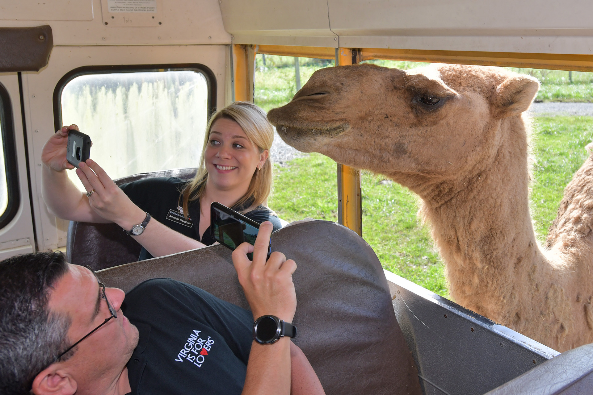
7 THINGS TO SEE AND DO IN WYTHEVILLE THIS SEASON
Wytheville and Wythe County are all about fun and experiencing incredible attractions that you will only find here in our small but bountiful part of Southwest Virginia.

5 RESTAURANTS IN WYTHEVILLE THE LOCALS LOVE
Due to its stellar location at I-81 and I-77, as well as some divine cuisine, Wytheville has long been known by travelers as THE place to stop and have some great food.
ROMANTIC GETAWAYS IN WYTHEVILLE
With a historic boutique hotel and an award winning luxury bed and breakfast, Wytheville is a great destination for your romantic getaway.

BEST MOTORCYCLE RIDE IN WYTHEVILLE
Featuring more than 200 miles of incredible scenery, Claw of the Dragon is one of the most popular bike rides in the South among motorcycle enthusiasts.
Wind: 1mph NE
Humidity: 48%
Pressure: 30.19"Hg
UV index: 0
52°F
50°F
50°F
48°F
70°F / 52°F
79°F / 52°F
82°F / 55°F
75°F / 55°F
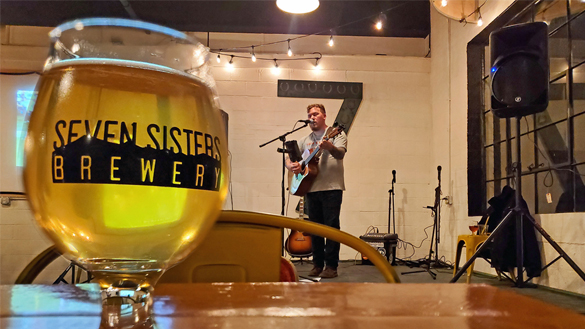
SEVEN SISTERS BREWERY - LIVE MUSIC
HAPPENING NOW
Craft Beer, Live Music, Food Trucks

7 DOGS BREWPUB - LIVE MUSIC
HAPPENING NOW
Craft Beer, Open Mic, Trivia, Live Music

Legends: The Eagles, The Doobie Brothers, & Fleetwood Mac
HAPPENING NOW
March 24 - April 8
Join us for the rockin’ music of 3 of the best bands of the 70s!